The Federal Government is partnering with NIGCOMSAT to integrate satellite technology into Customs operations.
The move aims to strengthen border surveillance, curb smuggling, and enhance trade efficiency across Nigeria.
The Federal Government has intensified efforts to integrate satellite technology and geospatial intelligence into the operations of the Nigeria Customs Service (NCS) as part of a broader strategy to combat smuggling, enhance national security, and promote efficient trade facilitation.
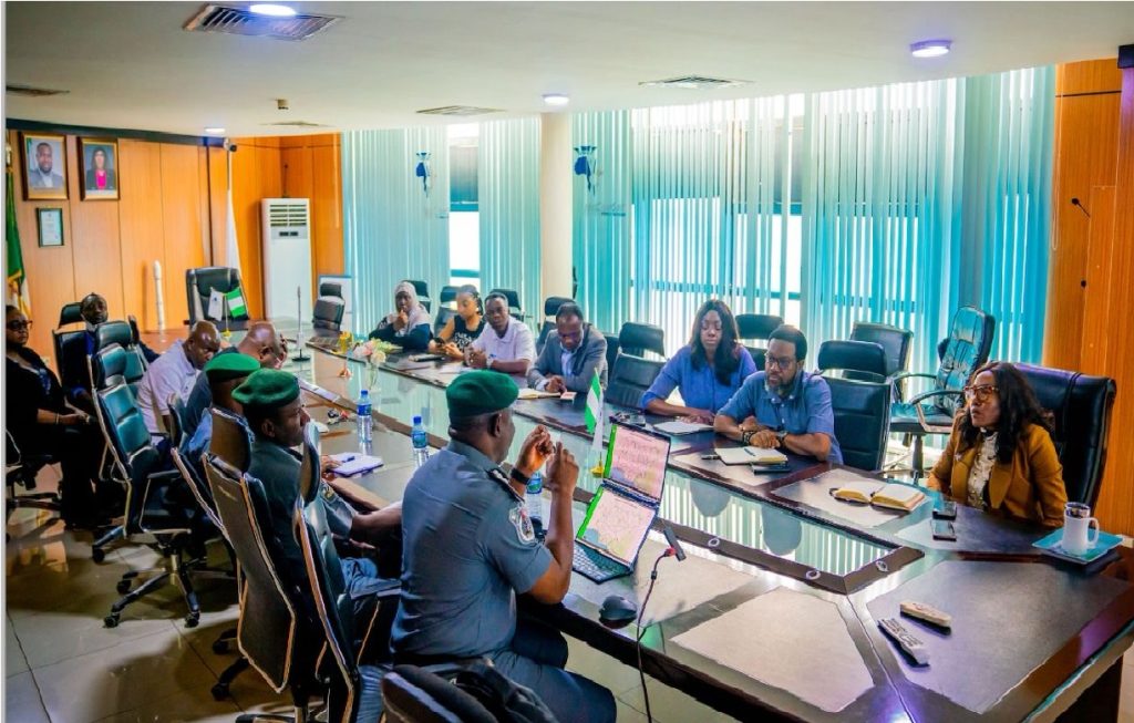
Discussions on the initiative were led by the Chief Executive Officer of Nigerian Communications Satellite Limited (NIGCOMSAT), Jane Egerton-Idehen, who confirmed that her agency recently hosted a high-level delegation from the Customs Service in Abuja.
According to her, the collaboration aims to modernize border enforcement and trade monitoring through the use of satellite communication systems and geospatial data tools.
“The Nigerian Customs have been at the forefront of enforcing trade laws, stopping smuggling, and collecting duties for the nation. There are opportunities to enhance these operations using technology, particularly through communications and geospatial data,” Egerton-Idehen said.
A follow-up session was held at NIGCOMSAT headquarters to deepen discussions on practical integration. The Customs team was led by Deputy Comptroller Ahmed Labaran, head of the service’s Geospatial Unit, and included senior officers overseeing operations and enforcement.
The meetings explored how satellite-enabled mobility solutions could help Customs improve surveillance and communication in remote and border regions where traditional infrastructure is limited. Egerton-Idehen said the collaboration would support field officers with secure data-sharing and real-time intelligence for joint operations.
“These services will ensure efficient operations for the Nigerian Customs Service, strengthen border security, and facilitate smoother trade processes,” she explained.
Nigeria loses billions of naira annually to illegal trade, especially fuel smuggling, a challenge the Customs Service has been addressing with new technology.
In 2024, the NCS announced plans to deploy Geographic Information System (GIS) tools and satellite imagery for border surveillance and anti-smuggling operations. At the time, the NCS National Public Relations Officer, Chief Superintendent Abdullahi Maiwada, said the agency’s target was to combine digital mapping and georeferencing to create a more predictable enforcement strategy aligned with global standards.
“We are looking forward to using satellite images and GIS to develop a stronger enforcement framework in line with global best practices,” Maiwada said.